![]()
The towns of Hampden County, MA in 1894.
The originals of these maps are 22" x 33". The original book had some water stains and these carried onto the upper portions of the maps. I think the stains add character and they do not obscure the map detail. Like the Hampshire County maps, these maps include the names of the residents and businesses where the density and map scale allow.
Hampden County,
Massachusetts
1894 City Maps
Agawam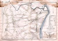 |
Brimfield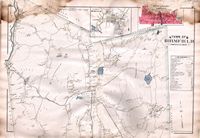 |
Chester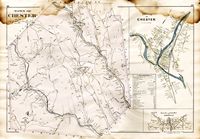 |
|
Chicopee City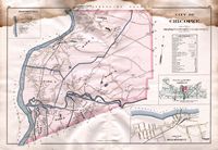 |
Chicopee Center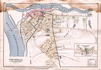 |
Chicopee Falls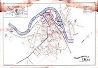 |
|
East Longmeadow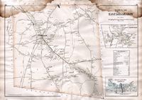 |
Granville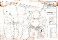 |
Hampden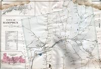 |
|
Holyoke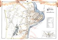 |
Longmeadow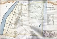 |
Monson Town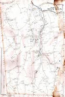 |
|
Monson Village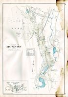 |
Palmer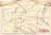 |
Palmer & Three Rivers |
|
Russell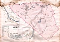 |
Southwick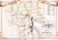 |
Springfield City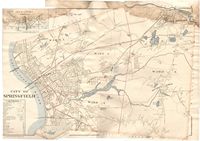 |
|
Springfield
(northern)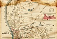 |
Springfield
(southern)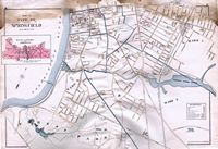 |
Tolland |
|
Wales & Holland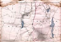 |
Westfield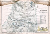 |
Wilbraham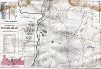 |
|
West Springfield Town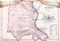 |
West Springfield Village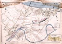 |
||
